The Village
Having said that the village only came into existence comparatively recently it is essential, before going any further, to explain how this locality has been described at various times.
Surrey means “south region” and originally was probably the southern part of a Saxon kingdom occupying part of the huge forest which once spread across southern England. This region was subdivided into “hundreds”, perhaps so called because they each contained one hundred families. One of the thirteen hundreds of Surrey was the Hundred of Woking which was in turn divided into a number of Lordships, or Manors. Those of principal concern to us were Burpham and Worplesdon, and the nearby Manor of Sutton.
The area which today comprises the village of Jacobs Well was in the Manor of Burpham. Some of the documents of the 16th, 17th and 18th centuries refer to “Teresworth within the Manor” and it seems possible that this name was used for that part of the Manor which lay to the west of the River Wey.
The Manor of Burpham was bounded by the Manors of Worplesdon to the West, Sutton-by-Guildford to the North, and Stoke-by-Guildford to the South. The boundary between Worplesdon and Burpham ran across Whitmoor Heath, possibly roughly where the railway is now; at a much later date the Woking road was defined as the western boundary.
Burpham’s eastern neighbour was West Clandon but we have treated the River Wey as limiting the area of our prime concern.
This was the way in which the county, as it became after William the Conqueror gave control of the old English shires to his Norman Counts, was organised by its temporal rulers. However the Church had a separate administrative structure, consisting of parishes. The whole of Surrey was in the Diocese of Winchester, within which the parish of St Mary’s, Worplesdon embraced the two Manors of Worplesdon and of Burpham. In 1859 St Luke’s Church, Burpham, was built as a Chapel-of-Ease to St Mary’s.
In 1920 Burpham was removed from the parish of Worplesdon to form a new ecclesiastical parish together with
Sutton Green. In 1927 Guildford became an independent Diocese. Jacobs Well was included in the parish of Burpham-with-Sutton until October 1960 when the village became part of the new Conventional District of St Peter’s, Hazel Avenue. Meanwhile the Earl of Onslow, whose family had held the Manor of Burpham since 1720, sold it in 1905.
The Electoral Register seems to provide the simplest definition of today’s village, covering as it does the “triangle” described in the Foreword. However it also includes half-a-dozen outlying properties not covered by this study.
The Name – Jacobs Well
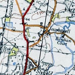
The earliest occurrence of the name which we were able to find was on the Ordnance Surveyors’ drawings made for their survey of 1806-1807. These drawings are kept in the Map Library of the British Library. The resultant map was not published until 1816. The words “Jacobs Well” are written beneath the stretch of Clay Lane between the Woking Road and Blanchards Hill.
However a map of Surrey published in 1823 by Christopher and John Greenwood places the name quite clearly at the crossroads and names Hurst Farm at the junction of Clay Lane and the Woking Road.
The first occurrence of the name in the Worplesdon parish register is the record of the baptism of Ann, daughter of John and Mary Gunner, on 26th June 1836.
The Tithe map of 1841 does not show the name and the Tithe Apportionment documents refer only to “Jacobs Well field” which lay immediately east of Blanchards Hill, and was divided into five strips, shared between three owners.
In 1963, in response to an editorial question in the Surrey Advertiser about how Jacobs Well got its name, Mr H. Farris wrote in to say that the answer was really quite simple. “In my boyhood days”, he wrote, “there was, in the bank on the other side of the road, opposite to Willow Grange, an ancient brick well.” (There is still a low brick wall at about this spot.) “Owing to its age and the fact that it was a roadside well, everybody knew it as Jacob’s Well. In the area around there were only a very few houses and it was to this area that the old well gave its name. I know that it was still there in the late 1890s.”
In 1983, after a report of the sale of Jacobs Well Cottage had included a comment that the well in the garden might be the one from which the village got its name, the above idea surfaced again. Mr Lawrie Grey, who was born in the cottage in 1915 and lived there until 1935, expressed his support for Mr Farris’ view that the village took its name from the well on “Treeby’s Hill”. As Mr Matthew Alexander, Curator of Guildford Museum, suggested at the time, it is not inconceivable that the well referred to was named after the village, rather than the other way around. All maps and documents including Census Returns and Electoral Rolls, but with the slightly ambiguous exception of the first OS map mentioned above, distinguish three separate areas – Jacobs Well at the crossroads, Hurst at the Woking Road, and Stringers Common almost everywhere else.
Before leaving this subject it seems worth mentioning that on the map drawn by Daniel Sarll in 1686 there is a small, unexplained, symbol at the approximate spot described by Mr Farris; in 1841 the adjacent field was named “Well Field”.
THE LOCALITY
While the name “Jacobs Well” has not been found in any documents or on any maps dated earlier than the beginning of the Nineteenth century, it is clear that “Hurst” was the principal local name for several hundred years before that – and continues in use today at Hurst Farm and Hurst View.
It comes from the Saxon word “hyrst” meaning a woodland clearance or a wooded eminence. In the days when the whole of Surrey lay within the Royal Forest of Windsor this must have been an apt description of the ridge which runs East-West just north of the present village.
Robert de la Hurst
The earliest mention of Hurst appears in 1290, during the reign of King Edward I, when:-
“ William le Frances of Worplesdon granted to Agnes de la Hurst his tenement which Robert de la Hurst her father formerly held of him in Villa de Teresworth apud la Hurst, under a rent of 3s 7p”. ”
“Apud” is the Latin for “at” while Villa de Teresworth is an archaic name which may have applied to that part of the Manor of Burpham which lay west of the River Wey.
The name Hurst next appears in 1332, during the reign of Edward I’s grandson, Edward III, when Roberto ate Hurst in the Villata of Burgham was assessed for tax of 8d. It seems not unlikely that he was a descendant of the earlier Robert.
Documents which can tell us where people lived and to whom they were related are rarely dated earlier than 1538 when Henry VIII’s chief minister, Thomas Cromwell, ordered the clergy to start keeping registers of all baptisms, marriages and burials. Not many such registers survive but the original parish register of St Mary’s, Worplesdon is still in existence – although the volume for the period 1718-1776 fell to pieces. There was rarely any indication of the part of the parish where anyone lived, except in the names of some of the more important parishioners such as knights, gentlemen and yeomen.
Thomas Russell of Hurst
The first mention of Hurst in the Worplesdon parish register is the burial of “Alice Russell, widow of old Thomas of Hurst” on 2nd April 1595.
Only a few months earlier the register records the baptism of “Alice, daughter of young Thomas of Burfam” on 15th December 1594 followed soon after by her burial on January 6th 1595 and the baptism of her sister Agnes on March 7th. It seems probable that in due course Thomas of Burfam became another Thomas of Hurst.
So far we have no indication of the exact location of Hurst but we can get a pointer from the fact that an overseer of the will of Thomas the Elder in 1600 was “Thomas Crosse, brother-in-law” and a supervisor of the will of the next Thomas of Hurst in 1619 was “William Crosse my neighbour”.
Jumping ahead to 1678 we find that their grandsons “Thomas Russell of Hurst” and “William Cross of Hurst” are both listed among some 70 names in a special section of the parish register which records that:-
“The Churchyard Railes of the Parish Church of Worplesdon are to be made by those whose names are here underwritten together with the true measure thereof in manner and form following.”
So it is clear that the name applied to the location of the homes of two prominent and related families.
William Crosse
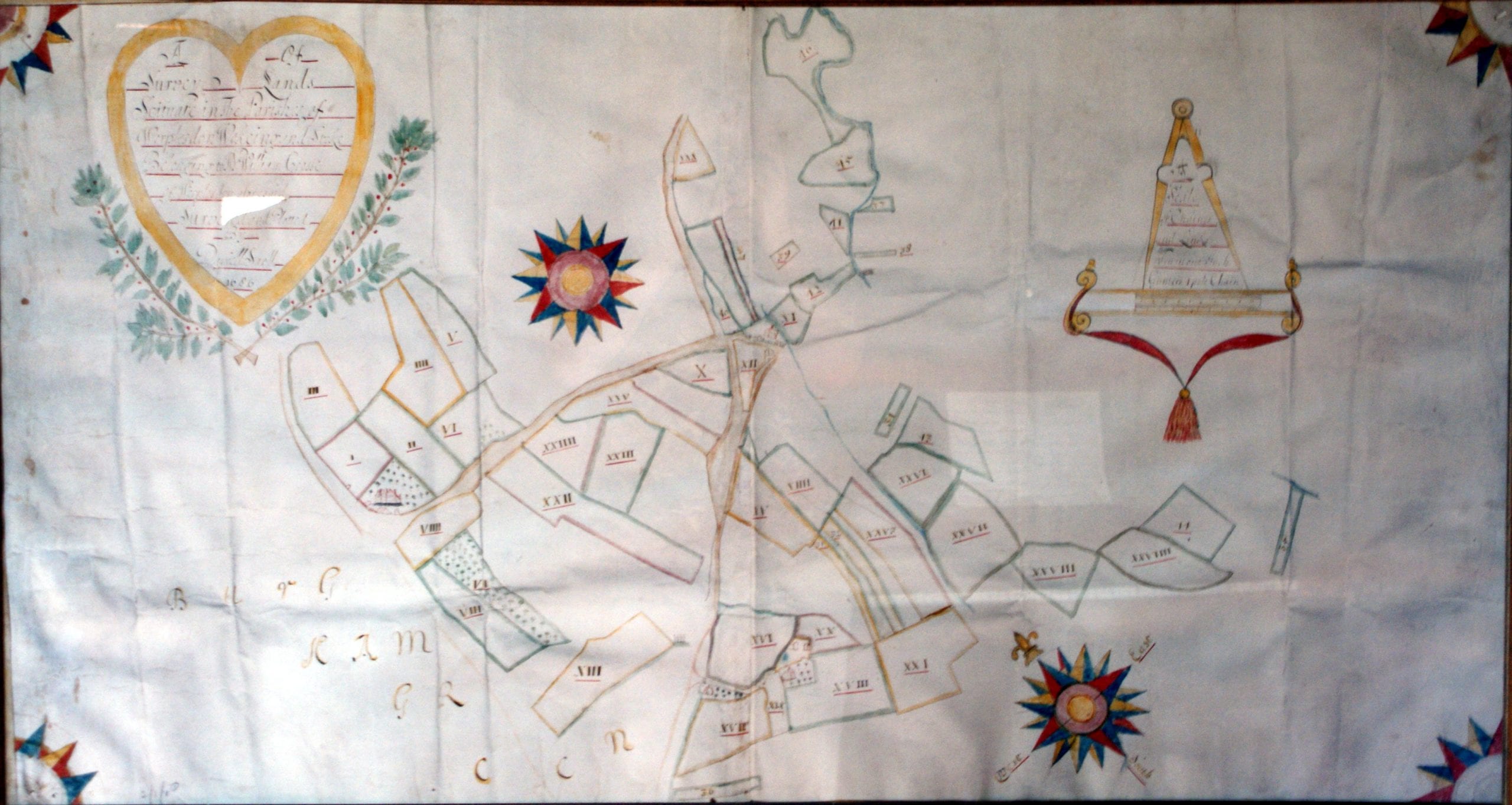
A few years later, in 1686, Daniel Sarll was commissioned to make “A Survey of Land scituate in the Parishes of Worplesdon Wokeing and Stoke belonging to Mr William Crosse of Worplesdon aforesaid”. The resultant map, in the archives of Guildford Muniment Room, clearly depicts the house now called Burpham Court House. An accompanying terrier, or list of land holdings, defines 47 plots totalling over 107 acres and the map shows that these lay wholly to the east of the Woking Road. It illustrates only the Crosse property, which included Watts Farm, Watts Cottage and a house at the crossroads which was eventually demolished early in the twentieth century. The blank areas correspond with what were later called Queen Hythe, Queen Anne and Jacobs Well farms. What we now know as Stringers Common was then called Burgham Green.
It seems reasonable to conclude from what we have learnt about the relationships between the two families that the Russell family lived opposite in the house now called Willow Grange.
Architectural evidence indicates that the “Crosse” house is an early 17th century building but contains earlier parts dating from around 1500 and from the late 16th century. The east wing of the “Russell” house is even older, being a complete medieval hall house of yeoman status, probably built in the early 15th century.
In 1693, not long after Daniel Sarll drew his map of the Crosse estate, John Senex published a map of Surrey. It depicts few roads but uses a special symbol to denote “Gentlemens Houses” – no doubt thereby encouraging purchase of the map by the gentlemen thus honoured.
Hurst, which was probably intended to refer to both houses, is among the few names shown north of Guildford, such as Sutton (Place), Stoughton (Place) and Burpham (Court Farm). It also appears on the map in John Aubrey’s opus sub-titled “A Perambulation of the County of Surrey”, which he began in 1673 and completed in 1692.
The 1877 Auction Sale
On Saturday 21st April 1877 an auction sale was held at the White Hart in Guildford (now Sainsbury’s High Street store) at which the attendance was so large that the sale had to be moved to the “commodious ballroom“. In the Particulars of Sale the neighbourhood was said to be “select and particularly desirable for Residence” while the properties were described as “offering several tempting sites for building” as well as including “tracts of rich grazing land next the River Wey“. The locality commanded “most extensive views in all directions“, including Frimley Ridges, Knapp Hill and the Brookwood asylum to the north, and to the south “the bold elevation of the Hog’s Back” as well as the Grand Stand at Newland’s Corner, on the racecourse which preceded Epsom.
Lot 1, described as part of Hurst Farm consisted of the house west of the Woking Road and just over 35 acres between the road and the railway. The house was described as “A Comfortable Old-Fashioned Farm House” built of brick and tile and containing “5 Bed Rooms, 2 Parlours, Kitchen, Pantry, Brewhouse, Dairy, etc.” The adjacent homestead comprised “A Barn, 2 Cow Sheds for 13 Cows, another Cow House for 6 Cows, Cart Horse Stable for 4 Horses, Chaff House, Meal House, Pigsty, with Farm Yards and Productive Gardens.” These buildings were located between the house and the Woking Road.
A small two-roomed cottage, just north of “Briton’s Pond”, was included in this lot.
Lot 2, another part of Hurst Farm, comprised the house east of the road, divided into 5 tenements of 3 rooms each, together with a stable for 4 horses, a shed, a farmyard, a large garden and two fields, totalling over 34 acres in all.
Neither of these lots reached their reserve prices
Neither did Lot 4 consisting of Queen Hithe farmhouse and 46 acres, nor Lot 7, comprising Watts Farm, Watts Cottage and 55 acres. In fact, out of the total of 200 acres on offer, the only sales actually achieved were of 8 small plots totalling just over 10 acres. The auctioneers had claimed that “some of the lots form fine natural building sites specially adapted for the erection of First-class residences or large Public Buildings” but clearly the time was not yet ripe and the development of the area hung fire for another 30 years or so.
The report of this sale in The Surrey Advertiser & County Times includes an example of Victorian humour:- “Lot 16, a small piece of pasture land in Upper Hook Mead, was bought by Mr F. Smallpeice, acting for Lord Onslow, for £45.”
In the sales particulars it was stated that Mr Burt, who occupied the whole of the property and had been the tenant for over 30 years, had been given notice to give up possession at Michaelmas. Sadly he died soon after the date of the auction, a few months before his 70th birthday. In due course Robert Ferguson, a Scotsman, took over the tenancy and moved into Hurst Farm with his wife, two daughters and step-daughter. The 1881 Census describes him as farming 125 acres. By this time his landlord was George Moss of Stockwell Green in south-west London, and the old Crosse house, which had been known as the Old Barracks for a short period, was called Hurst Farm Cottages, still containing five households.
On 16th February 1898 Messrs Daniel Smith, Son and Oakley conducted another auction on the instructions of the trustees of the late Sir William Bovill. This time the property for sale comprised the two parts of Hurst Farm as well as Watts Farm, totalling “upwards of 129 acres“. Robert Ferguson had been given two years’ notice to quit but he was still there in the spring of 1900, as the tenant of Charles Burgess of Godalming.
GREAT HURST
William Crosse raised a number of mortgages between 1691 and 1715, possibly to extend his holdings by the acquisition of some of the Russell lands, and after his death in 1719 his youngest daughter, Mrs Elizabeth Leeves, took out further mortgages. When she became a widow in about 1758 she took out yet another mortgage in conjunction with her daughter and her son-in-law, Samuel Ayling.
Samuel Ayling and his wife duly inherited Hurst but because he came from Petworth in Sussex they leased it to Worplesdon farmers.
Part of their property, described as “Great Hurst” and comprising 60 acres, appears to correspond to the old Russell house and lands. The first tenant of this was William Wells, who then moved to Queen Hythe Farm. In 1762 he was followed at Great Hurst by Joseph Cobbett who signed a lease for 21 years at an annual rental of £50. This document provides a fine example of legal detail in a clause which committed him to “Sufficiently hedge ditch Fence Scower Gripe Cleanse mend maintain and keep All and every the hedges ditches posts pales Rails Gates Stiles Gripes Fences and Inclosures belonging to the said Demised premisses”. There were also clauses defining the manner in which he was to make and use compost, and the condition in which a portion of the ground was to be left at the end of the lease.
The lease was apparently extended beyond its specified termination in 1783 because he continued to be recorded as the occupier right up to his death in 1795, when he was described as “Farmer, Burgham aged 74 years.” His place was taken by his son John who farmed the property even after the deaths of Samuel Ayling and then of the widowed Elizabeth Ayling in the early years of the nineteenth century. The death of the latter marked the end of the association of the Crosse family with Hurst.
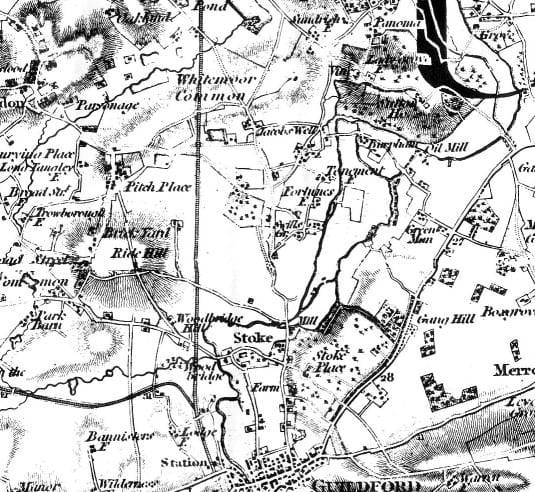
In 1823 Christopher & John Greenwood published their one-inch/mile map of Surrey which names Hurst Farm and places Jacobs Well at the crossroads. This map was accompanied by a book charmingly entitled:-
“Surrey Described, being an Enumeration of the Seats and Residences of the Nobility, Clergy and Gentry of the County.”
The entry for Hurst-Farm describes it as “a good house and farm, the residence of James Smallpeice”. In 1826 the heirs of Mr and Mrs Ayling sold Hurst Farm to Richard Sparkes, but James Smallpeice continued as tenant. It is intriguing to speculate whether he was remotely related to Peter of Hurst’s sister Elenor Russell who had married John Smallpeace in 1616.
By this time the old Crosse house had been converted into tenements, or apartments, for the farm labourers.
The Tithe Act
In 1836 the Tithe Act was passed to commute tithes in kind (ie produce) into money payments. To do this a survey of every parish was undertaken, including a large scale map denoting every plot and building. The only properties actually named on the Burpham portion of the Worplesdon map are “Hurst Farms” and “Queen Hive Farm” (sic) and there is no mention of Jacobs Well.
In the accompanying tithe apportionment John (not James) Smallpiece is identified as the owner of Hurst Farm Homestall, west of the road, together with just over 57 acres, while Richard Sparkes remains the owner of the house, yard and buildings and 116 acres east of the road. However by this time the occupant of both properties was George Burt.
George Burt
The apportionment was completed in May 1838 and confirmed in March 1841. This was census year, and it was the first census to include names and other personal details. From this we find that six families, including that of George Burt, were recorded as living at Hurst. Ten years later the census was even more explicit and George Burt was described as “Farmer, 200 acres, 8 labourers” living at Hurst Farm. Five other families were listed as living at Hurst, ie in the old Crosse house, but the heads of the households were not all farm workers. One man was a bricklayer and another was on Parish Relief, aged 67, while his wife was described as a pauper.
Subsequent census returns show that George Burt continued to live and farm at Hurst until 1871. However at some date, probably around 1856, his landlord became William Bovill, QC who was Member of Parliament for Guildford from 1857 until 1866. After his death in 1873 it was some time before the trustees of his will decided to dispose of Hurst Farm and his other properties nearby.
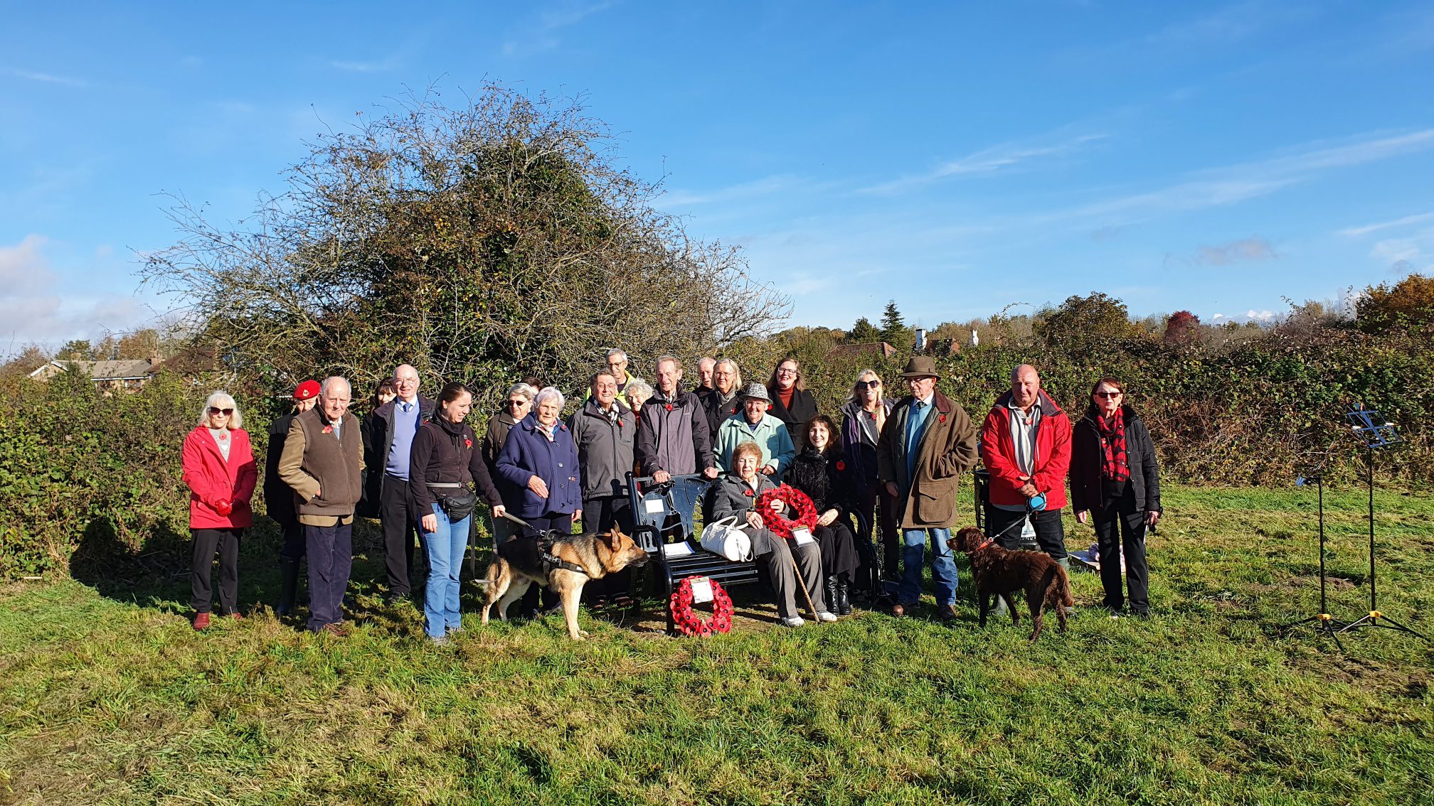
From information compiled by Jim Millar